Important Information
The information displayed on this map has been provided by our vehicle tracking system which uses GPS technology to send information from our gritters which updates the map.
The information provided on the map is for information only and supplements the information shared through social media. It should not be regarded as comprehensive and no guarantee is given that the information is entirely accurate - for example weather conditions may change, or there may be connectivity or technical issues with the tracking system.
This map only displays the priority one routes. It takes approximately 2 ½ hours to complete a full route.
If a route is closed for maintenance the diversion will be gritted instead. However this will not show on the map.
In this respect, Durham County Council disclaims all liability and responsibility arising from any reliance that you or anyone else places on such information.
Before using this map please read our website disclaimer and mapping copyright information.
Help
How to use the map
- Open the key to find out what time period is covered by the map.
- Search box (magnifying glass icon) - use this to zoom in on a particular location by entering your postcode or town / village.
- Find my location (compass icon) - use this to zoom in on your current location.
- Reset (house icon) - use this to reset the map to the show the whole county.
- Back arrow - use this to return to the winter service information area of our website.
Find out when a section of road has been gritted
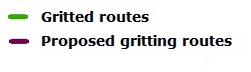
Click on the green road you want extra information about and text box will appear with the date and time the road was last treated. This is updated every 15 minutes whilst the gritters are operational.
Some text boxes will display multiple screens (which can be scrolled through using the arrow button), this occurs when several roads or sections of road start or finish at the same point. You can check you are viewing the correct information, as this section of road will be highlighted in green to illustrate that it corresponds to the information on display. If this is not the information you want just scroll through the screens until the required area of road displays in green, and the correct text appears.
No routes displayed?
This means there is no gritting planned for the time period specified if no roads are highlighted in purple. If no road is shown in a specific area then no gritting is planned for that area.
How often is the information updated?
The map is reset every 12 hours at 2.00am and 2.00pm, for the following 12 hours, confirming all proposed and completed gritting during this period.